Capital to Tahoe Trail
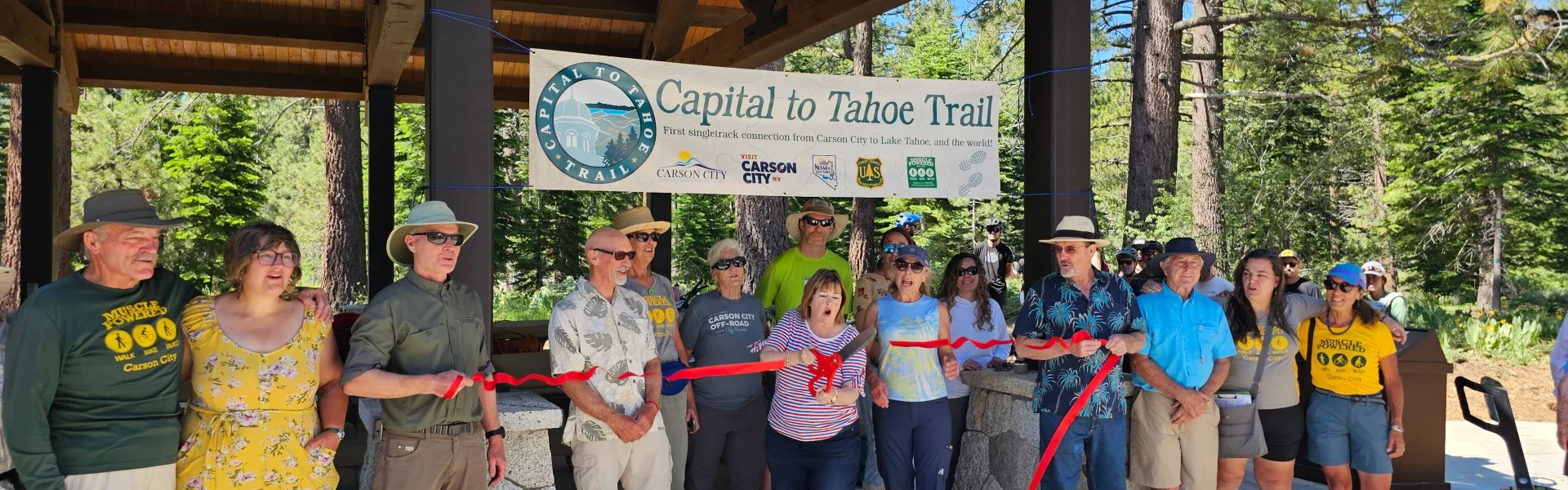
The Capital to Tahoe (aka Cap to Tahoe) Trail is finally complete and ready to hike and ride!
Pick up a free Cap to Tahoe Sticker at the Visitors Center at 716 N. Carson St, Suite 100, Carson City, NV 89701.
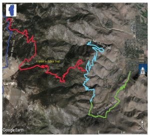
Just completed in 2023 this exciting new trail completes the first single-track connection from Carson City to Lake Tahoe, and the world! From the steps of the State Capital, a hiker may take King Street to quickly reach a single-track trail (the Lincoln Bypass Trail) which could take you on an incredible journey of 1,152 miles to Mexico or 1,606 miles to Canada. The Capital to Tahoe Trail is the culmination of a 8-year effort by Muscle Powered, along with Carson City, Nevada State Parks, the U.S. Forest Service, a Private Landowner, and many committed individuals.
This trail affords beautiful views of Carson City and Washoe Valley, but be aware that it is a long and remote trail. Be prepared for changes in the weather, and always carry the 10-essentials!
The trail is accessed from the Ash-to-Kings Trail. It crosses U.S. Forest Service lands, a private parcel, and Nevada State Park lands. A full hike or ride from Carson City is accomplished by taking the Lincoln Bypass Trail (4.4 miles), to the Ash-to-Kings Trail (2.6 miles), and then taking the Capital-to-Tahoe Trail (9.8 miles) to the Tahoe Rim Trail. Total one-way is 16.8 miles.
Length:
9.8 Miles
Difficulty:
IMBA Rating is BLUE (More Difficult). Typical width is 24″, with an average grade of 6%, and maximum grades of 19%.
Type of Trail:
Singletrack, natural-surface trail, and the tread is dirt with some rock. Hiking/running, mountain biking, and horseback riding are permitted (equestrian users are cautioned to watch to mountain bike traffic).
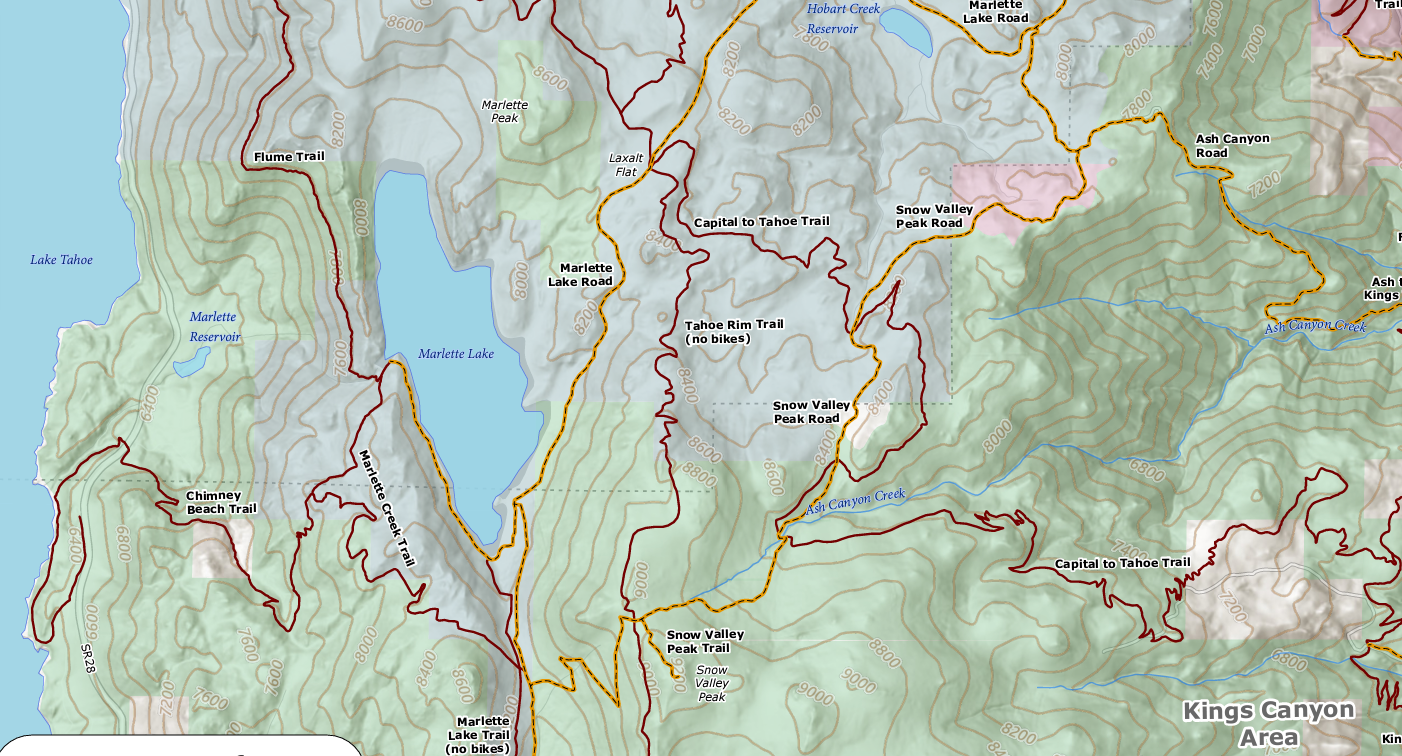
CLICK HERE for the link to the West Side Trails Map above